Search and Rescue Satellites


360 Degrees Rotation Use your mouse or drag your finger left/ right over the image.
GPS 3 – one of the three MEOSAR constellations that provide worldwide activated 406 Beacon signal coverage with amazing detection and location speed.
The Space Segment
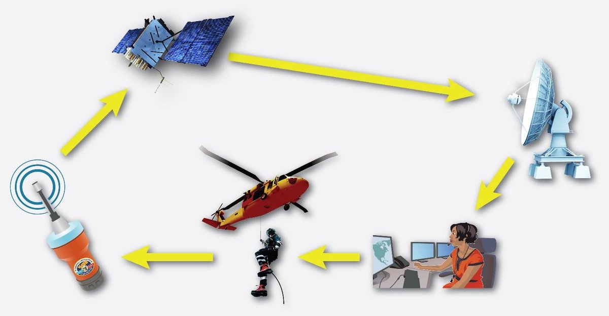
The Cospas-Sarsat system is made up of a number of satellite constellations that carry SAR instrument payloads on board. These satellites “Listen for” and detect 406 MHz distress beacon signals that have been activated back on earth.
Graphic courtesy of Cospas-Sarsat
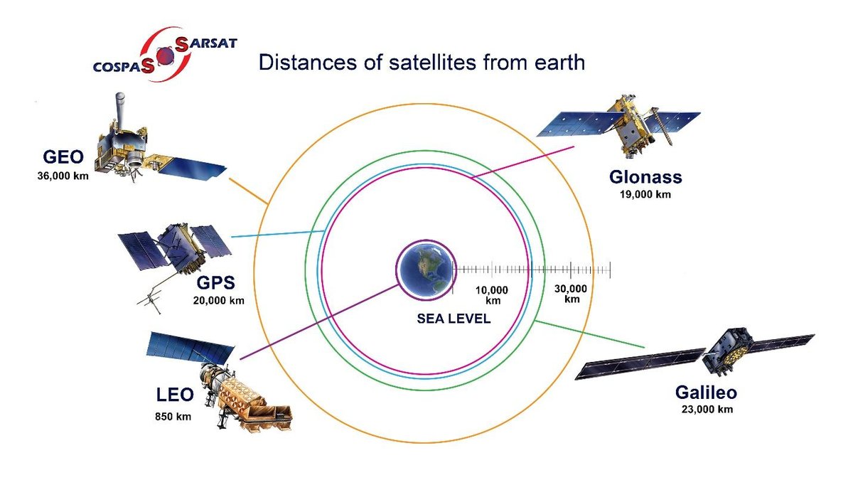
The distance each of the Cospas-Sarsat satellites are from earth and the type of orbit they follow determines what beacon location information they can provide and how quickly location accuracy can be determined and confirmed.
Because of this vantage point in space, and depending on the type of satellite, the coverage area can vary from thousands of square kilometres to almost 1/2 the planet. Satellites in the Cospas-Sarsat programme are provided by a number of countries including the United States, the European Space Agency, Russia and India.
Graphic courtesy of Cospas-Sarsat
Each satellite that picks up the beacon distress signal sends it to the nearest compatible ground station for processing. The resulting data is combined with data from other satellites to calculate an accurate location.
All satellites regardless of their country of origin, can download distress alerts to all partnered LUTs anywhere in the world within range of their signal. There are three types of satellites in the Cospas-Sarsat system – Low-Earth Orbiting Search and Rescue (LEOSAR) satellites; Geostationary Orbiting Search and Rescue (GEOSAR) Satellites; and Medium-Altitude Earth Orbiting Search and Rescue (MEOSAR) Satellites. These satellites perform other tasks including weather and climate monitoring, communications, and navigation.
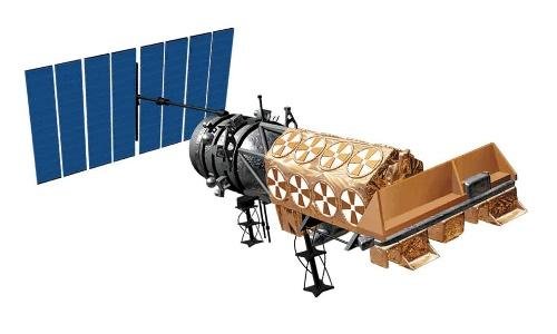
NOAA Low Earth Orbiting (LEO) satellites, also known as POES (Polar Operational Environmental Satellites) circle the globe from the North to South Pole. They do a complete orbit once every 102 minutes.
LEOSAR Satellites
The primary mission of Low Earth Orbiting (LEO) satellites is to monitor Earth’s weather, environment, and climate. Another equally important mission it carries out each and every day is search and rescue. These satellites, operationally known as LEOSAR, have the ability to detect and locate activated 406 distress beacons worldwide. In fact, they were the first category of satellites to carry SAR instrument payloads when the idea of Search and Rescue Satellite- Assisted tracking (SARSAT) was implemented back in the early 1980s.
Graphic courtesy of Cospas-Sarsat
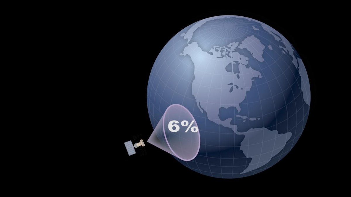
LEOSAR satellites are positioned at an altitude of approximately 850 kilometers into space and circle the Earth once every 102 minutes.
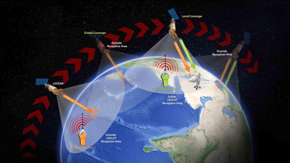
Their orbits are inclined 99 degrees from the equator which means LEO satellites are polar orbiting. Since LEOs are close to the Earth, they “see” less territory because of the limited field of view from the antennas onboard each satellite. Their low altitude, combined with the relatively small number of satellites in this constellation, LEOSAR satellites must fly over an activated distress beacon to pick up the signal and then be in view of a LEOLUT (ground station) to transmit the signal. This is what is called non-continuous coverage.
Graphic courtesy of Cospas-Sarsat
Repeater instruments on board LEOSAR compensate for the fact that LEOSAR satellites are not always in contact with a ground station by storing and replaying activated 406 beacon information until it can be downloaded.
Orange = beacons outside LEOLUT reception area. Green = beacons inside LEOLUT reception area.
LEOSAR satellites are equipped with a Search and Rescue Processor (SARP) which receives 406 MHz transmissions and records the frequency and time it picked up the signal. This information is stored in a Search and Rescue Repeater (SARR) until it can be downloaded to a LEOLUT. No on-board position processing is performed.
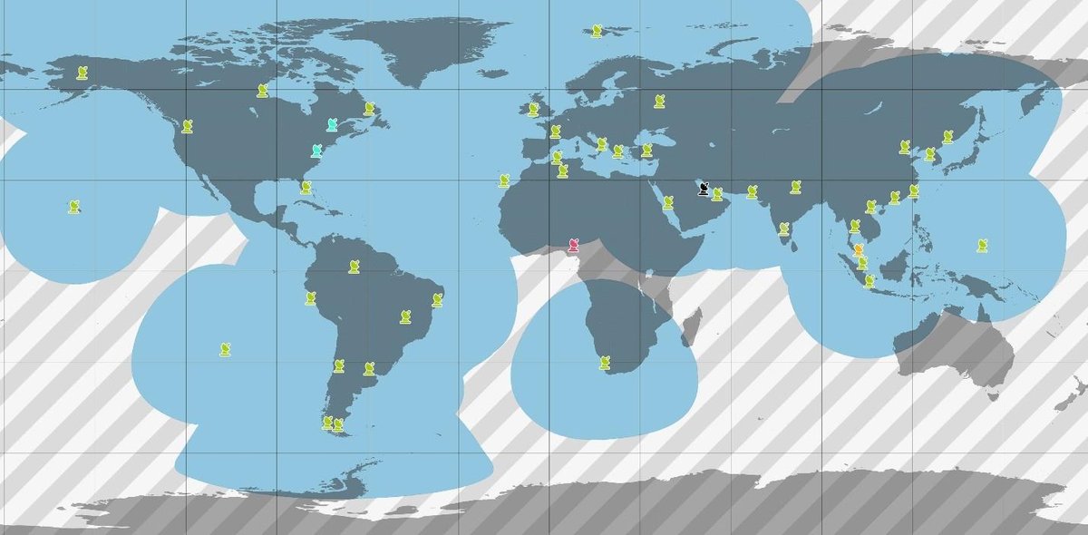
In this illustration the Blue area = Local Coverage. The striped area = Global Coverage. While in Local Coverage range, a LEOSAR satellite can immediately download a beacon signal to a LEOLUT. However, with Global Coverage, the download is delayed until the satellite is again in view of a LEOLUT.
There are two possibilities… Local Coverage and Global Coverage. If the satellite is in Local Coverage range, meaning in view of a LEOLUT (ground station) when the beacon signal is activated, it can immediately download the distress signal information. If it is not in view of a LEOLUT, it is in Global Coverage range. Here the satellite stores and constantly re-transmits the activated distress beacon signal information as it continues along its orbit path. Then the next ground station that “sees” that satellite will receive the data. It resends this data for up to 48 hours ensuring ground stations around the world receive it.
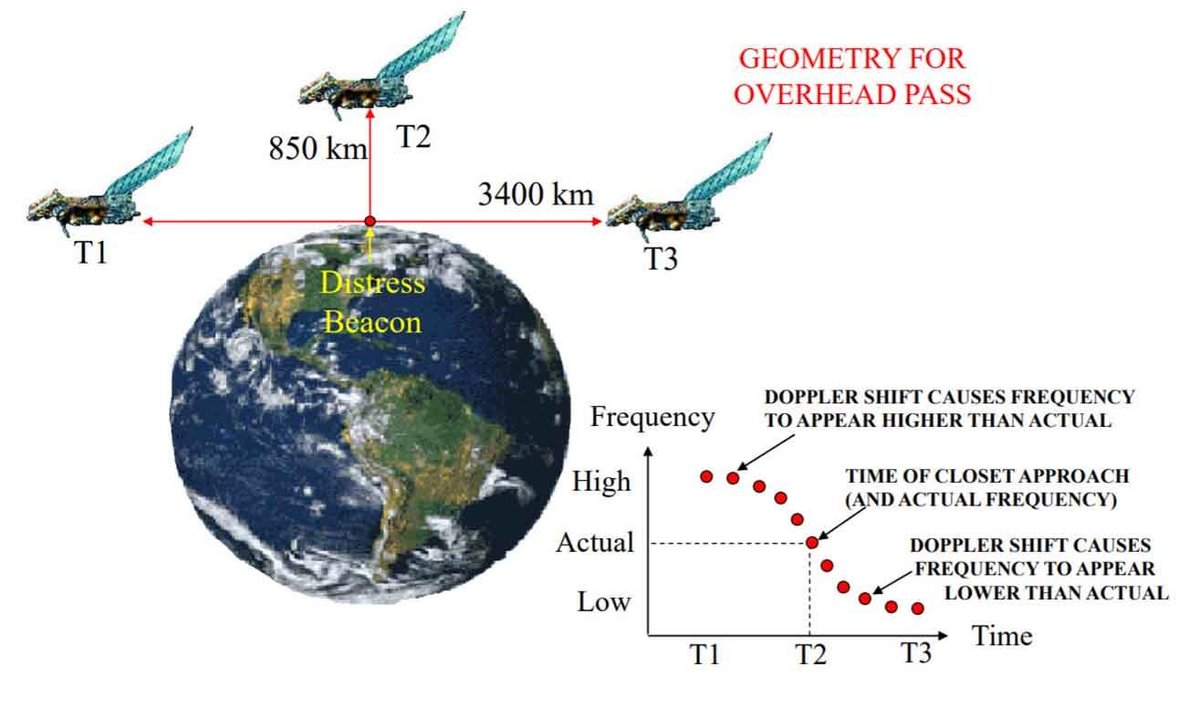
Determining the location of the beacon
Doppler processing is done by the LEOLUT to determine the true beacon location based on when the activated beacon signal was received. The LEOLUT calculates the frequency shift of the 406 beacon signal relative to the motion of the satellite. It takes at least three beacon bursts to calculate a Doppler position estimate. Each LEOSAR satellite pass over the detected beacon generates two position estimates, often called the A and B position. One will be close to the correct beacon location. A second satellite pass is required to resolve the ambiguity and identify the correct beacon location.
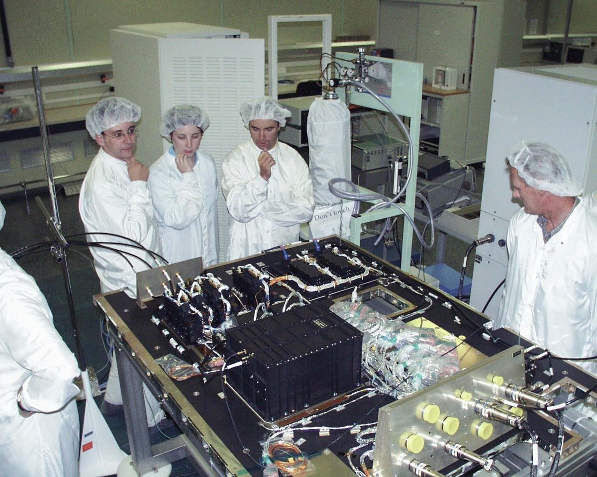
Image courtesy of Jim King Archives
This image shows an early version of the SARP Processor / SARR repeater combination that is part of the payload on SARSAT satellites even today.
The NOAA series of SARSAT satellites are operated by NOAA’s National Environmental Satellite, Data and Information Service (NESDIS). The SARR repeater is provided by the Canadian Department of National Defence and the SARP Processor is provided by the French Centre National D’Etudes Spatiales (CNES).
LEOSAR Constellations include:
-
- NOAA Polar Orbiting Environmental Satellites (POES) – known as ‘SARSAT’
- ESA/EUMETSAT Polar Orbiting Meteorological Satellites (MetOp) – also known as “SARSAT”.
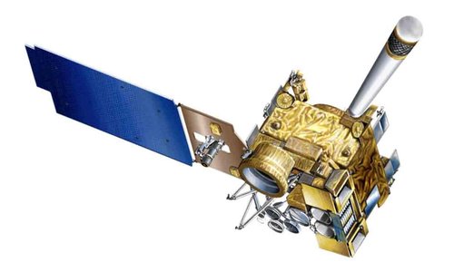
NOAA’s latest generation of Geostationary Operational Environmental Satellites (GOES) provide continuous monitoring and advanced imagery and atmospheric measurements of Earth’s weather, oceans, and environment. From their fixed position they provide a constant vigil regarding severe weather conditions and storm development.
GEOSAR Satellites
Geostationary (GEO) satellites circle the Earth in geosynchronous orbit, which means they orbit the equatorial plane of the Earth at a speed matching the Earth’s rotation. This allows them to hover continuously over a fixed spot on the surface.
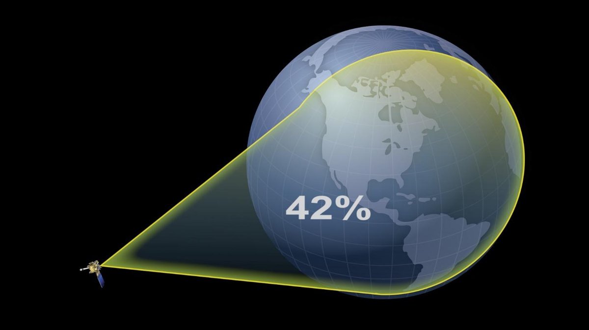
Graphic courtesy of Cospas-Sarsat
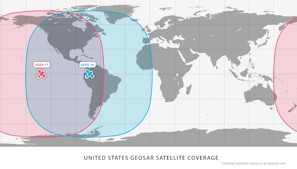
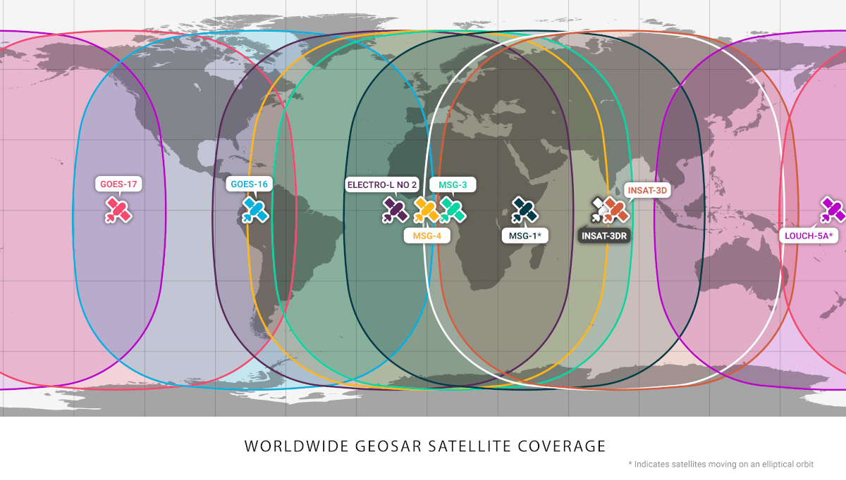
Geostationary (GEO) satellites, in orbit just under 36,000 kms above the earth, are capable of continually viewing large areas of our planet. There are 9 active GEO satellites carrying SAR payloads.
GEO satellites carrying SAR payloads on board are called GEOSAR satellites. Due to the global coverage these GEO satellites provide, they are able to immediately detect and identify a 406 MHz distress beacon that has been activated.
This animated illustration shows the almost-total global coverage provided by all nine International GEOSAR satellites as well as the specific coverage provided by the two U.S. GEOSAR satellites.
This is a valuable tool for SAR personnel since it allows them to begin their initial verification of the alert using the National 406 MHz Beacon Registration Database. Often this detective work yields general information about the direction and destination of the vessel or aircraft in distress, its description, the number of people on board, etc… Time is everything. This knowledge means SAR assets can be readied and, in some cases, dispatched to that general area. The GEO satellites are not able to use Doppler location processing since there is no relative motion between them and the activated 406 beacons. Therefore, they are not able to determine a location for a beacon.
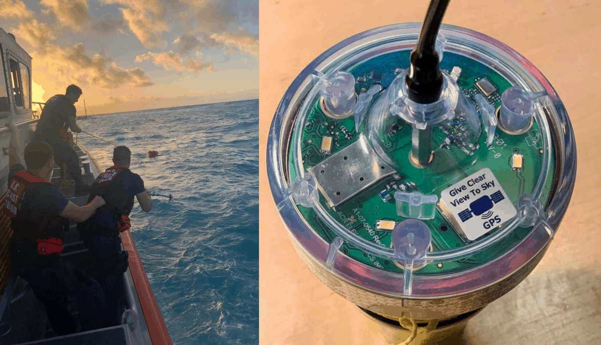
GPS Encoded 406 Beacons such as the EPIRB pictured here, help get rescue crews to the scene of a distress faster. The positional accuracy is generally around a football field in size.
However, if the 406 beacon is encoded, meaning a Global Positioning System (GPS) chip is integrated into the beacon, or it is hooked up to an external GPS receiver, the advantage of being detected by a GEOSAR satellite is significant. This accurate location information is then embedded into the 406 MHz distress message that is transmitted by the beacon. The U.S. Mission Control Center (USMCC) receives that signal including the encoded GPS location and notifies the Rescue Coordination Center (RCC) accordingly. This information can often be derived in a matter of minutes! Since every second counts in reaching the scene of a distress this means that there is an increased chance of survival.

Image courtesy of DIVIDS
Without a doubt, the early warning capability of the GEOSAR constellation provides a valuable tool to increase the effectiveness of the Cospas-Sarsat system, help SAR responders get there faster, and, ultimately, save more lives.
GEOSAR Constellations include:
-
- NOAA Geostationary Orbiting Environmental Satellites (GOES)
- ISRO Indian National Satellite (INSAT)
- ESA Metosat Second Generation (MSG)
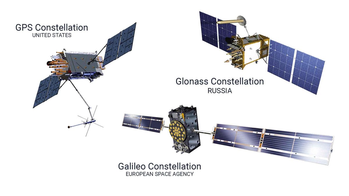
These GNSS constellations make up the present MEOSAR Space Segment. At full strength there will be at least 75 satellites providing 406 beacon detection service.
MEOSAR Satellites
The latest evolution of Satellite-aided Seach and Rescue for Cospas-Sarsat is the addition of Global Navigation Satellite System (GNSS) medium-earth orbiting (MEO) satellites to the system. Their primary function is to provide signals from space that transmit positioning and timing data to GNSS receivers. The receivers then use this data to determine location. Precision atomic clock timing sources coupled with an ultra stable oscillator are required at this orbit.
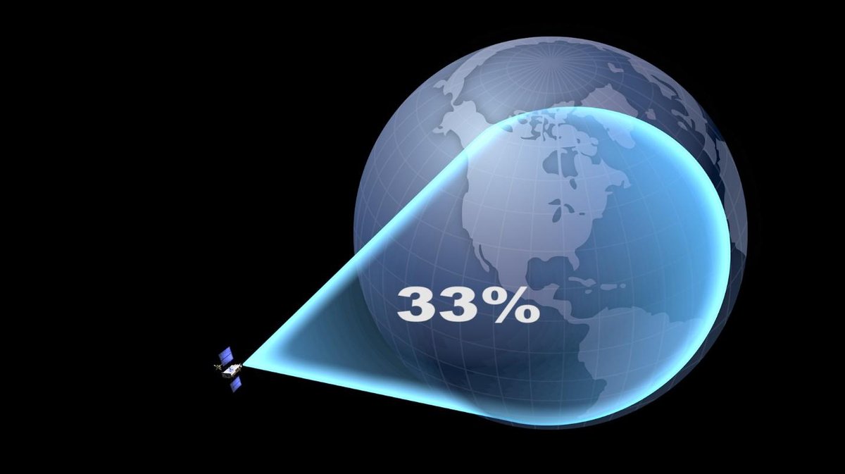
Graphic courtesy of Cospas-Sarsat
MEOSAR satellites orbit the Earth at an altitude of between 19,000 and 24,000 kms. The satellites are positioned so that there is an overlap of at least 4 satellites for any given region of our planet.
MEOSAR search and rescue payloads are carried on GNSS (Global Navigation Satellite System) satellites including GPS, GLONASS, and GALILEO. GPS is operated by the United States, GLONASS by Russia and Galileo by the European Space Agency. The SARR repeater on board GPS satellites is provided by Canada.
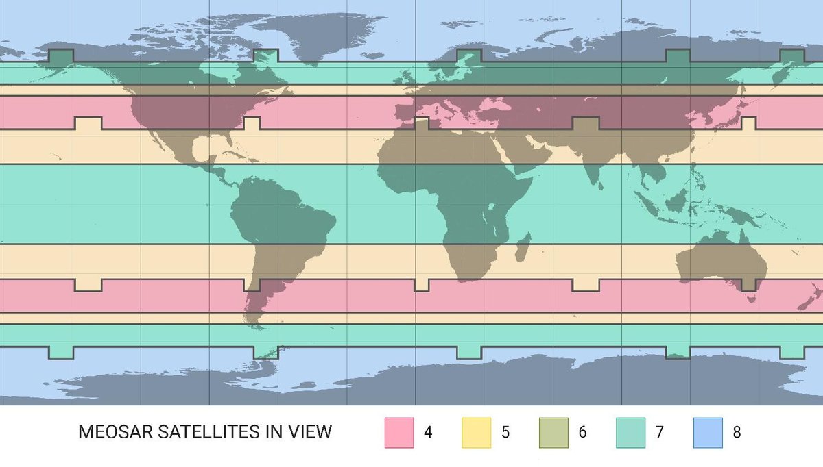
Operational MEOSAR Local Coverage Footprints… This map indicates that for every 406 beacon located anywhere on Earth, between four and eight MEOSAR satellites could be ‘seeing’ it simultaneously.
With a footprint covering approximately 1/3 of the earth, MEO constellations provide global coverage and real-time alerting capability worldwide without the need to store the data and relay it at a later time. Each constellation will consist on average about 24 satellites arranged in orbits that ensure no less than four SAR equipped satellites are visible from anywhere on Earth at any time.
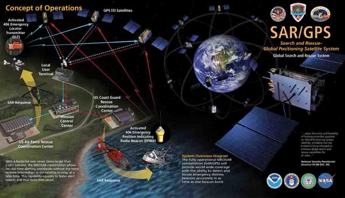
MEOSAR brings to Cospas-Sarsat an enhanced distress alerting capability characterized by near instantaneous global detection of emergency beacons, improved location accuracy, high levels of redundancy and availability, robust beacon communication links, and improved flexibility against obstruction and interference. Trilateration – a kind of 3D triangulation algorithm using frequency difference of arrival (FDOA) and time difference of arrival (TDOA), are used to calculate the location of the 406 beacon after as little as one beacon signal burst. With decreased detection times and increased accuracy, as well as open architecture that will allow for future innovations to be integrated the system, MEOSAR will not only equate to reduced SAR costs, but most importantly, more lives saved.
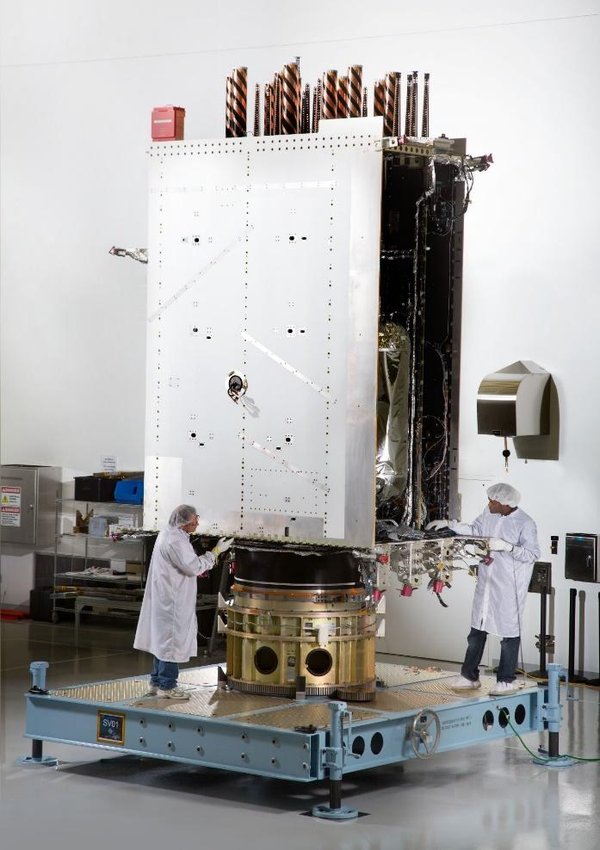
Image courtesy of NASA
The Image above gives some perspective on the size of a GPS III satellite.
MEOSAR Constellations include:
-
- United States’ Global Positioning System Satellites (GPS)
- Russia’s Globalnaya Navigazionnaya Sputnikovaya Sistema (Glonass) Satellites
- European Space Agency Galileo Global Positioning Satellites
What makes this New System Different?
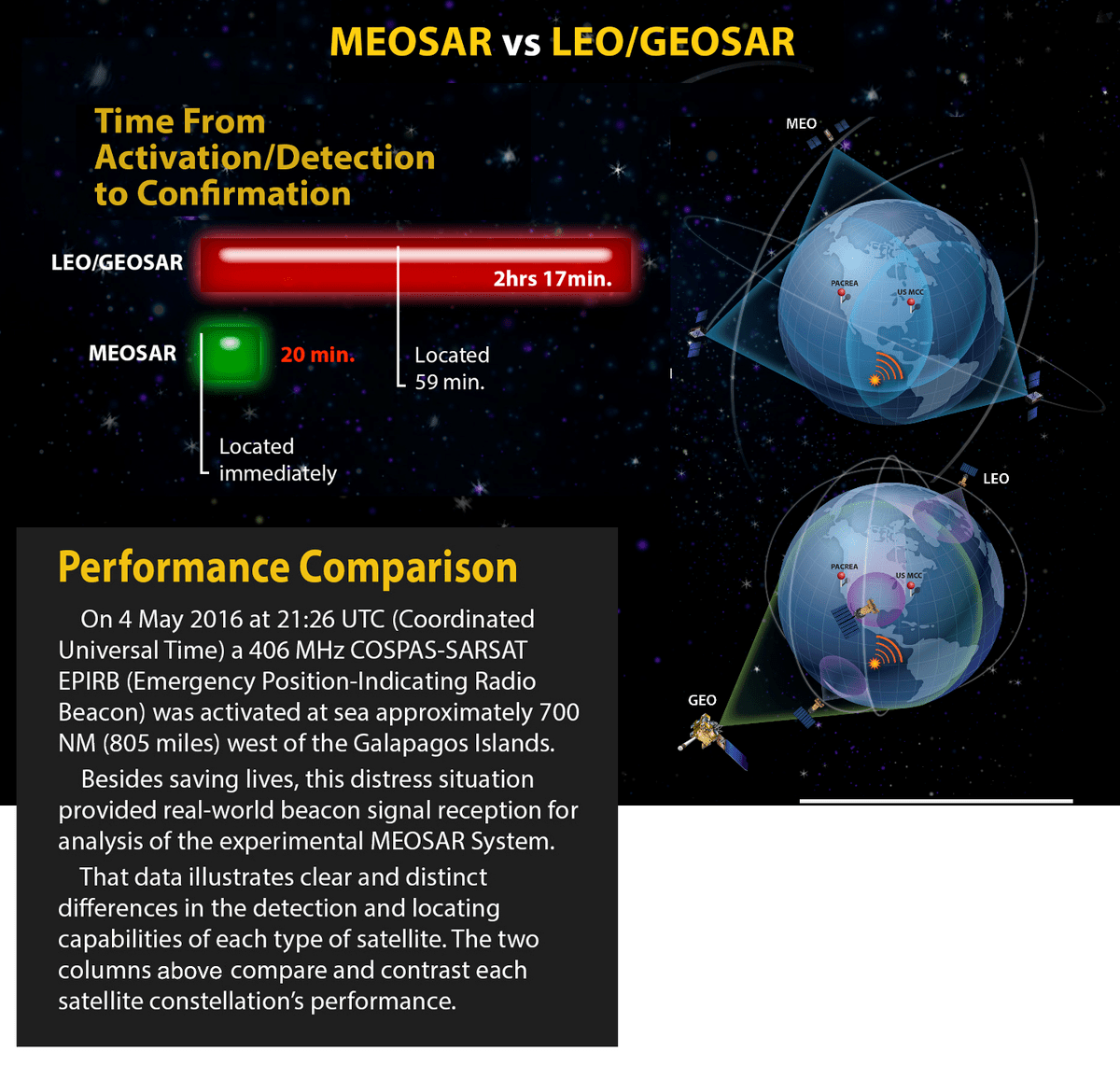
The MEOSAR system has been designed to overcome the various shortcomings of the LEO/GEOSAR systems. For example: GEOSAR satellites cannot calculate the location of a 406 beacon, only detect its activation unless the beacon is encoded. LEOSAR satellites are few in number and only orbit every 100 minutes, which means they cannot provide blanket coverage of the earth. This means LEOSAR satellites only pick up 406 beacon bursts when they fly over the location of the distress. And they cannot relay the message until they are in sight of a ground station. This can cause a delay in an alert message being received by SAR authorities. MEOSAR does not have these issues because of their coverage area and the multiple satellites in view of a particular portion of the Earth at any one time. Click here for specific examples of MEOSAR performance.
Satellite Constellations
Search and Rescue Standards are set and overseen by COSPAS-SARSAT, an international satellite system for search and rescue. The SAR payloads are being placed on MEO satellites used for navigation by the United States, Europe and Russia.

Image courtesy of Cospas-Sarsat
It only takes a few minutes to register your 406 beacon.
It also means we get there faster if you need help.
Register Your Beacon
You need to do your part so if you need our help and activate your beacon., we can be a lot better prepared when we arrive to rescue you. Without registration, the RCCs are unable to react as quickly…and ultimately this may delay a SAR response should you be in an emergency. If you have a 406 MHz beacon and have not registered it, please do so by clicking here to access the National 406 MHz Registration Database.
It’s the law and it may save your life!
